
National Library (left foreground), Parliament House (right rear).
National Library (left foreground), Parliament House (right rear).
Canberra Times Newspaper • ABC radio & TV Canberra • Canberra radio 666 • FM104.7 • Prime TV •
Canberra Citysearch • Canberra Citysearch Visitor-Guide • Canberra realty (sale and rent) • All Homes realty
ACT government portal Canberra Connect • Australia-wide Current Bushfire satellite images •
A.C.T. EMERGENCY SERVICES BUREAU •
Virtual Canberra•National Capital Authority•Canberra ACTEWAGL webcam
Weather: Canberra • Canberra weather radar • Snowy Mtns • South Coast
Canberra weather • Canberra webcam •

Canberra's Telstra Tower under a bushfire sky, January 18, 2003.

The countryside below Mt Tennant, January 27, 2003.
Devastation at Mt Stromlo observatory, part of the Australian National University.
Fire image links. Tim Grainger's photos from Duffy.
National Art Gallery of Australia • Australian War Memorial • National Library of Australia
Hands on science: Questacon • National Museum of Australia • Parliament House
Australian Institute of Sport • High Court of Australia
Mt Stromlo reconstruction webcam.
Perisher • Thredbo • Cooma • Jindabyne • Ski info • Hydroelectric Authority • Snow depths , Australian Alps National Parks, NSW National Parks,
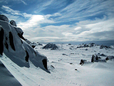
The ACT abounds with beautiful hiking opportunities. For example a walk to the summit 1857m summit of Mt Gingera - second highest in the ACT.
Some pictures of snowgums. Dawn views from Mt Townsend. My hiking web page.
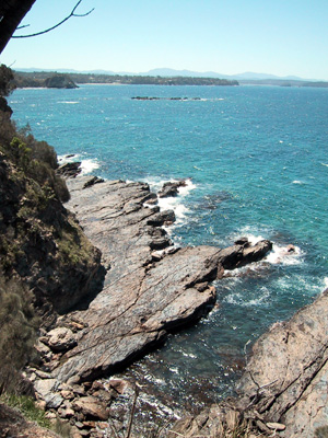
Saphire Coast • Eurobodalla • Mollymook • Southcoast info
Canberra Off Road Cyclists • Mountain Bike Australia
Quicktime Virtual Reality image (2MB). Move cursor to pan; ctrl = -; shift = +.
![]()
© Denis Evans, October 18, 2003.
There have been 296 visitors since 19 January 2007